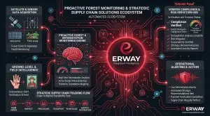


Absolute Forest Integrity
FIRST STEP
INGESTION
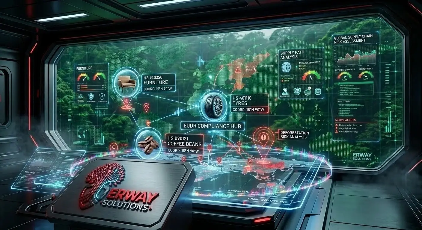
Supplier & Polygon Setup

The process begins by integrating comprehensive supplier metadata with high-precision plot-level geolocation data (polygons). This step establishes the digital foundation for monitoring, ensuring every monitored hectare is correctly mapped and assigned to its specific origin.
SECOND STEP
RISK ANALYSE
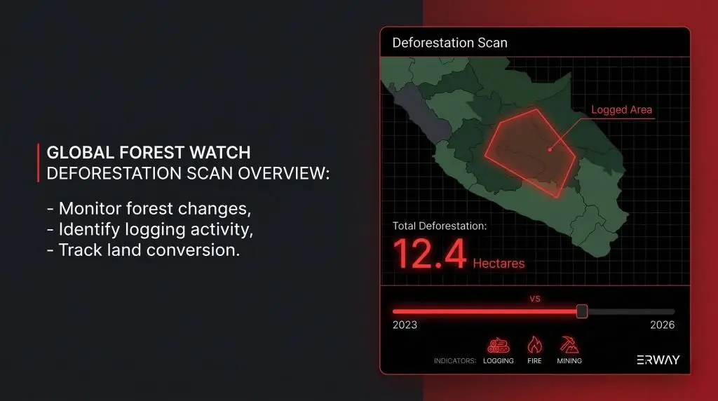
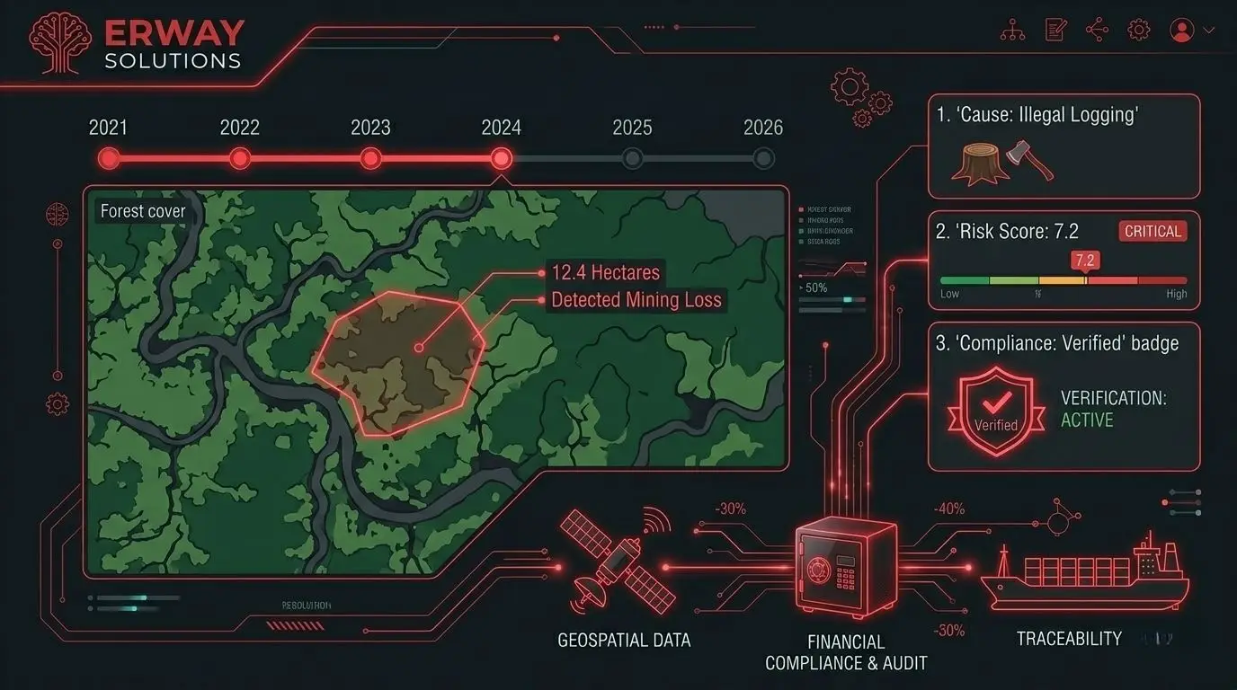
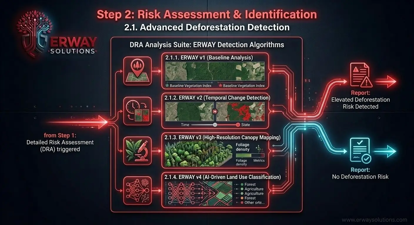
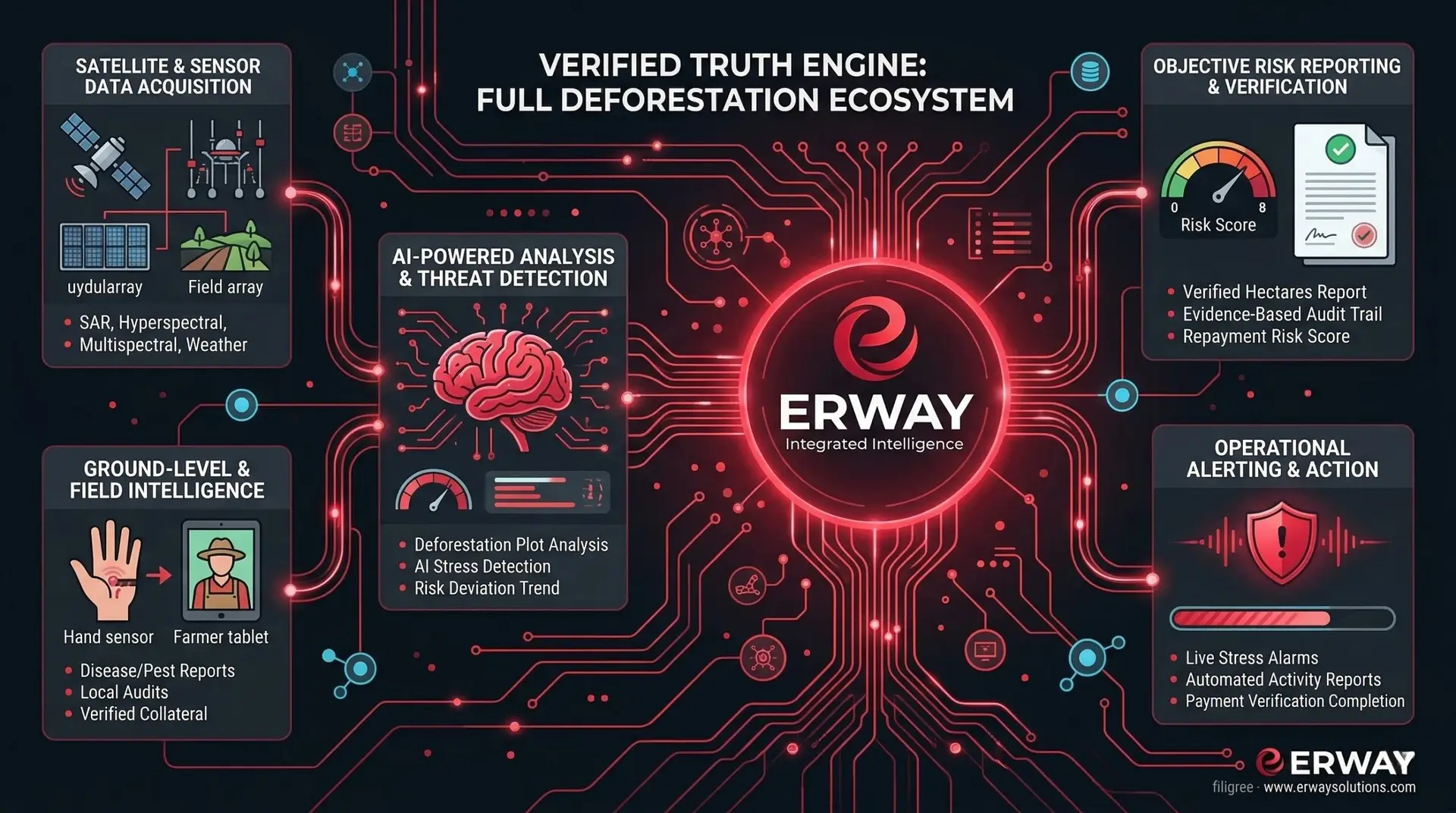
Predictive Risk & Deforestation Analysis

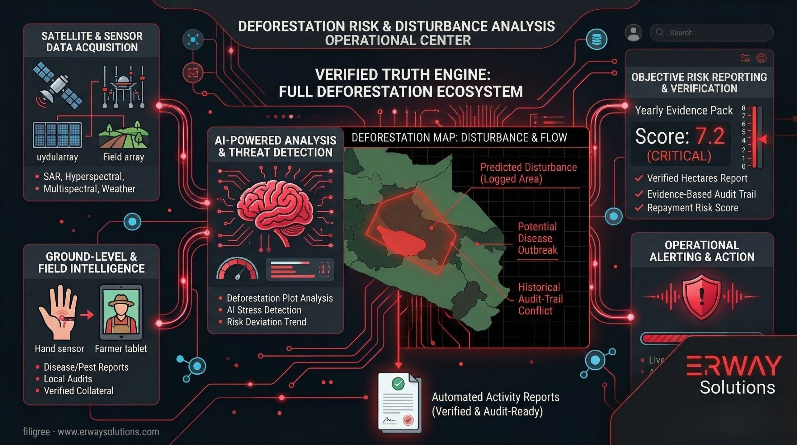
Utilizing ERWAY’s 6-satellite ecosystem, the platform performs advanced risk analysis to detect land-use changes. The system distinguishes between different drivers of forest loss, such as mining-related clearing, illegal logging, or wildfire damage, providing a multi-layered risk score.
THIRD STEP
EVIDENCE
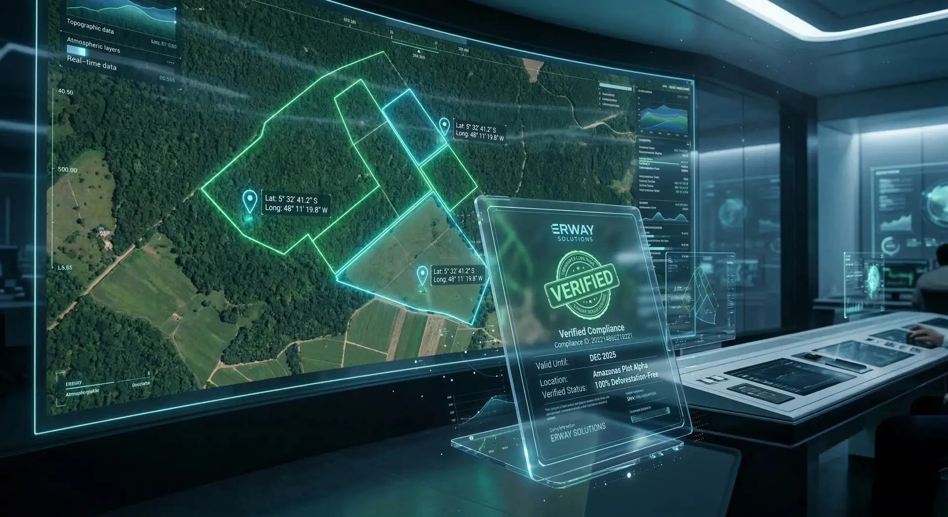
Automated Evidence Synthesis

High-resolution satellite evidence is generated to provide immutable digital proof of forest integrity or loss. This includes year-by-year time-series imagery and precise calculations of affected hectares, creating an audit-ready archive for regulatory review.
FOURTH STEP
DDS APPLICATION
Recommendations & Supply Chain Track

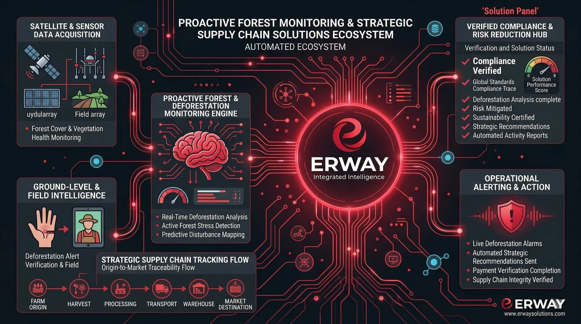
Based on the generated evidence, the platform provides tactical recommendations and solutions to maintain compliance. The commodity is then tracked throughout the supply chain to ensure a 100% transparent, deforestation-free journey from the forest to the end consumer.
FULL FLOW
What does do ERWAY ?
ERWAY FLOW

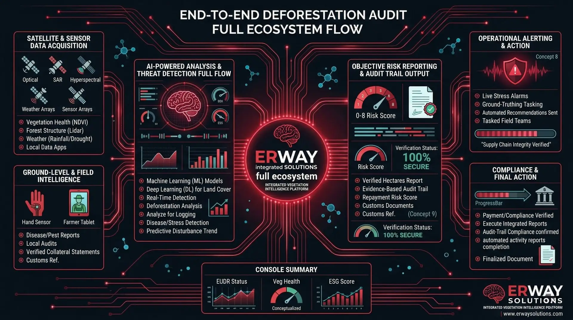
This final step visualizes the entire integrated flow: from the initial supplier data to the final audit-ready evidence pack. It represents the complete digital twin of the forest monitoring process, ensuring every stakeholder has access to a unified, geospatial truth engine for environmental integrity.
aboutERWAY’s Forest Monitoring platform

Erway
SLN.
The preservation of global forest ecosystems has transitioned from a sustainability goal to a strict legal mandate. ERWAY’s Forest Monitoring platform provides a specialized, satellite-driven defense against land degradation by delivering high-resolution deforestation analysis. Unlike general observation tools, our system distinguishes between different drivers of forest loss—including mining, illegal logging, and wildfire damage—offering a granular view of environmental impact that is essential for modern compliance and resource protection.
Our platform’s core strength lies in its ability to generate immutable evidentiary imagery, providing a year-by-year visual history of any given plot. By integrating multi-spectral satellite data, we don’t just detect a loss of canopy; we identify exactly when the deforestation occurred and calculate the precise number of hectares affected. This level of detail allows organizations to provide undeniable proof of land integrity or to identify liability with surgical accuracy, effectively eliminating the ambiguity often found in manual field reports.
In an era of increasing regulatory scrutiny, having access to comprehensive deforestation analytics is the only way to ensure operational security. ERWAY’s Forest Monitoring suite automates the generation of evidence packs that consolidate map outputs and legal documentation into an audit-ready format. Whether managing private timberlands or verifying global supply chain origins, our technology provides the geospatial innovation required to protect natural assets and maintain a transparent, deforestation-free footprint.
featuresThe unique selling points & advantages of our service
Experienced team
Emphasize the expertise and knowledge of your team in developing and implementing neural networks
Tailored solutions
Mention your ability to customize solutions based on specific business requirements
Cutting-edge technology
Highlight your use of the latest tools and techniques in neural network development
Proven track record
Showcase successful case studies or client testimonials that demonstrate the effectiveness of your services
faqEverything you need
to know about
Our platform provides specialized satellite-driven analysis to detect land-use changes and verify forest integrity in real-time. It serves as a digital assistant for exporters, banks, and insurers to ensure 100% compliance with global environmental standards .
ERWAY identifies various drivers of forest loss, including mining-related clearing, wildfire damage, illegal logging, and covert/hidden tree removal. The system distinguishes between natural disturbances and human-driven activities to provide a clear cause-of-loss analysis.
Using high-resolution satellite imagery, we identify unauthorized logging activities that deviate from approved forest management plans or EU environmental mandates. The platform provides yearly evidentiary imagery to document the exact timing and location of non-compliant removals.
Yes; the system monitors ground scarring and land-use changes specifically associated with mining operations. By providing a year-by-year history of the plot, we can prove if a forest area was converted into a mining site.
ERWAY generates Fire Intensity Heat Maps that categorize damage from low to high severity on a 16:9 visual scale . This documentation identifies the fire parcel and the exact date of detection to support insurance claims and damage assessment .
Our geospatial engine calculates the precise number of affected hectares down to the plot level. This objective data eliminates subjective estimates, ensuring that reports for regulatory bodies are audit-ready and accurate.
The Risk Scoring system categorizes the level of forest disturbance: 0 represents a reference state (no loss), while higher codes (up to 8) indicate confirmed critical loss $\ge$ 50%. This allows institutions to prioritize high-risk areas for immediate intervention.
Yes; we integrate supplier polygons with satellite analysis to provide an end-to-end “farm-to-table” traceability audit. This ensures that every commodity entering the EU market meets high standards of reliability and quality.
get in touchWe are always ready to help you and answer your questions
International Sales & Support For inquiries within Europe and international sales consultations:
Location: Vienna, AUSTRIA
Global Headquarters Our main hub for operations and innovation is located in the heart of Istanbul.
- Address: Antasya Residence, Umraniye, 34768, Istanbul / TURKEY
Mail: iletisim@erway.com.tr


