EUDR atbilstības programmatūra — no zemesgabala ģeometrijas līdz iesniegšanai ES.
ERWAY ir EUDR atbilstības programmatūra, kas piegādātāju zemesgabalu ģeometriju pārvērš satelīta mežu izciršanas riska intelektā — ar atbilstības automatizāciju līdz iesniegšanai gatavai Due Diligence Statement ES, neatstājot platformu.
Reģistrācija nav vajadzīga — demonstrācija darbojas pilnībā jūsu pārlūkā.
Pārskats
Kopējie procesi
128
Atbilstoši
96
Neatbilstošs
12
Lietošanas ierobežojumi
Riska novērtējumi
128/500
Daudzstūru augšupielādes
4.210/10.000
DDS augšupielādes
84/250
Procesu autorizācijas
37/50
Lietotāju izveides pilnvaras
12/25
Piegādātāja izveides pilnvaras
46/100
Jaunākie EUDR procesi
| Process | Prece | Izcelsme | Risks | Statuss |
|---|---|---|---|---|
Cocoa beans — Akrofuma Q3 PRC-24817 · HS 1801.00 | Cocoa | Ghana | 8 | Atbilstoši |
Arabica coffee — Montebrava PRC-24810 · HS 0901.11 | Coffee | Brazil | 14 | Atbilstoši |
Natural rubber — Hatvien PRC-24796 · HS 4001.22 | Rubber | Vietnam | 61 | Neatbilstošs |
Crude palm oil — Palmanusa PRC-24788 · HS 1511.10 | Oil palm | Indonesia | 44 | Pārskatā |
Soya beans — Ruvalda PRC-24771 · HS 1201.90 | Soya | Argentina | 22 | Atbilstoši |
Oak sawnwood — Codruna PRC-24759 · HS 4407.91 | Wood | Romania | 5 | Atbilstoši |
Viena darbplūsma katrai EUDR precei
7
Regulētas preces aptvertas
2020
Mežu izciršanas atskaites punkts piemērots
1-click
Due Diligence Statement iesniegšana
Platforma
Viss, ko pieprasa EUDR, vienā savienotā darbplūsmā
No zemesgabala ģeometrijas līdz iesniegtam paziņojumam — EUDR due diligence programmatūra, izsekojamība, riska novērtējums un ģeolokācija vienā savienotā plūsmā. Katrs modulis tīri nodod nākamajam.
Dzīvs atbilstības kontrolpanelis
Redziet visu savu EUDR portfeli vienā acu uzmetienā — atbilstoši un neatbilstoši sūtījumi, plāna izmantošana un jaunākie procesi, viss reāllaikā.
- Portfeļa līmeņa atbilstības un riska rādītāji
- Izmantošanas limiti riska analīzēm, poligoniem un DDS iesniegumiem
- Katrs nesenais process ar statusu un riska rādītāju
Pārskats
Kopējie procesi
128
Atbilstoši
96
Neatbilstošs
12
Lietošanas ierobežojumi
Riska novērtējumi
128/500
Daudzstūru augšupielādes
4.210/10.000
DDS augšupielādes
84/250
Procesu autorizācijas
37/50
Lietotāju izveides pilnvaras
12/25
Piegādātāja izveides pilnvaras
46/100
Jaunākie EUDR procesi
| Process | Prece | Izcelsme | Risks | Statuss |
|---|---|---|---|---|
Cocoa beans — Akrofuma Q3 PRC-24817 · HS 1801.00 | Cocoa | Ghana | 8 | Atbilstoši |
Arabica coffee — Montebrava PRC-24810 · HS 0901.11 | Coffee | Brazil | 14 | Atbilstoši |
Natural rubber — Hatvien PRC-24796 · HS 4001.22 | Rubber | Vietnam | 61 | Neatbilstošs |
Crude palm oil — Palmanusa PRC-24788 · HS 1511.10 | Oil palm | Indonesia | 44 | Pārskatā |
Soya beans — Ruvalda PRC-24771 · HS 1201.90 | Soya | Argentina | 22 | Atbilstoši |
Oak sawnwood — Codruna PRC-24759 · HS 4407.91 | Wood | Romania | 5 | Atbilstoši |
Aizstāvams mežu izciršanas risks, automātiski
Katrs process tiek novērtēts pa zemesgabaliem pret 2020. gada meža atskaites punktu, tad apkopots vienā secinājumā, ko varat aizstāvēt auditā.
- Meža zuduma un brīdinājumu blīvuma vērtēšana katram zemesgabalam
- Prece, HS kods, piegādātājs un ģeolokācija apkopoti kopā
- Skaidri atbilstošs / neatbilstošs / pārskatīšanā rezultāti
Crude palm oil — Palmanusa
Atmežošanas riska rādītājs
Apkopots, ņemot vērā mežu zudumu katrā parauglaukumā, trauksmes blīvumu un zemes seguma izmaiņas kopš 2020. gada bāzes līnijas.
Procesa detaļas
Prece
Oil palm · Crude palm oil
HS kods
1511.10
Piegādātājs
Palmanusa Estates
Ražošanas valsts
Indonesia
Kopējā zemes gabala platība
512,9 ha
GFC 2020 meža bāzes līnija
418.6 ha
Sižeta līmeņa rezultāti
Analizēti 5 diagrammas| Sižets | Apgabals | Meža zudums | Risks |
|---|---|---|---|
| PLT-01 | 12.4 ha | 0.0 ha | none |
| PLT-02 | 22.1 ha | 0.3 ha | low |
| PLT-03 | 8.7 ha | 2.4 ha | high |
| PLT-04 | 15.9 ha | 0.7 ha | medium |
| PLT-05 | 30.2 ha | 0.4 ha | low |
Satelīta pierādījumi aiz katra rādītāja
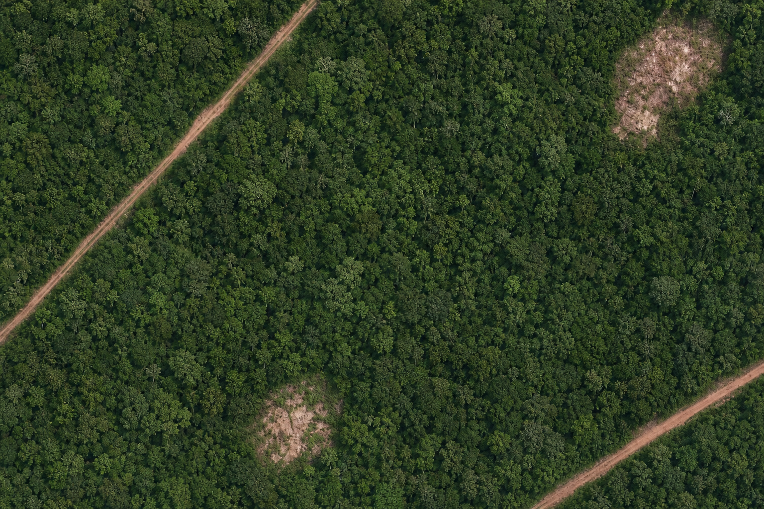
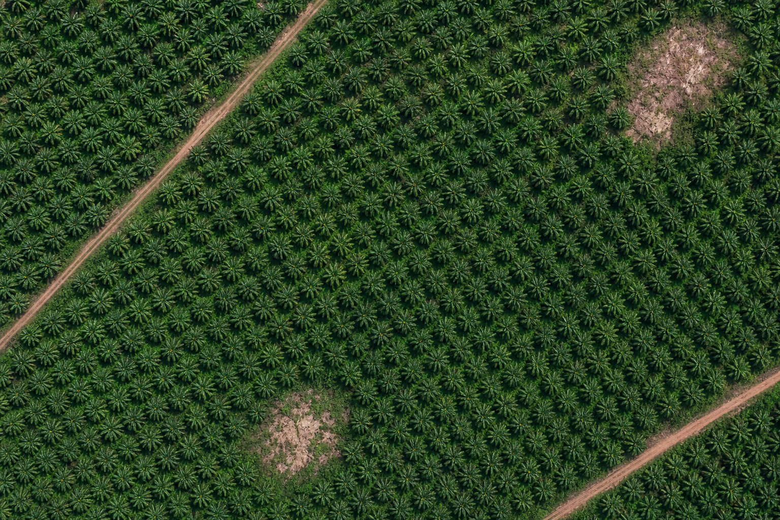
Pārslēdzieties no 2020. gada meža atskaites punkta uz šodienas reālo satelīta attēlu tajā pašā zemesgabalā — lai redzētu tieši to, kāda zeme izskatās tagad salīdzinājumā ar laiku pirms atskaites datuma.
- Pirms/pēc: 2020. gada mežs pret šodienas zemes izmantošanu
- Reāls augstas izšķirtspējas satelīta attēls
- Darbojas ar visām EUDR precēm
Mežu izciršanas analīze
Palmanusa Estates · 176 plots · Indonesia · velciet, lai salīdzinātu 2020. gadu ar šodienu
Slāņi
Leģendas krāsu kods
Gada zudums uz meža pamatkartes
Uzlieciet mežu izciršanu virs 2020. gada meža satelīta attēla — katra krāsa norāda, kad zemesgabala robežās tika izcirsts laukums.
- Meža pamatkarte bez pirms/pēc dalījuma
- Pa gadiem krāsota siltumkarte zemesgabala iekšienē
- Leģendas krāsu kods no 2020. gada līdz šodienai
Mežu izciršanas analīze
Palmanusa Estates · 176 plots · Indonesia · gadu no gada zaudējumi salīdzinājumā ar 2020. gada meža bāzes līmeni
Slāņi
Leģendas krāsu kods
Pārbaudiet katru piegādātāju pēc slēpta riska
ERWAY skenē uzraudzības, tiesu un ziņu avotus par katru piegādātāju un pārvērš atklājumus vispārējā riska rādītājā, brīdinājuma signālos un ieteiktajos nākamajos soļos.
- AI negatīvo mediju skrīnings par katru piegādātāju
- Atklājumi ar smaguma pakāpi un pamatojumu, kāpēc tie svarīgi EUDR
- Brīdinājuma signāli, trūkumi un ieteiktie nākamie soļi
Natural rubber — Hatvien
Hatvien Rubber JSC screened across watchdog, court and news sources. Score aggregates finding severity, source reliability and supply-chain proximity.
Hatvien Rubber JSC
Piegādātājs tiek pārskatīts
Ģeogrāfiskā pēda
Pārmeklēti aizstājvārdi
Mātes uzņēmumi
Meitas uzņēmumi
Atzinumi (2)
Finding 1 / 2
NGO report links concession to 2023 forest clearance
An investigative report alleges a supplying concession cleared natural forest in 2023, overlapping community-claimed land near the plot boundary.
Kāpēc tas ir svarīgi EUDR
Clearing after the 31 Dec 2020 cut-off on land feeding this consignment would make the commodity non-compliant and expose the operator to EUDR penalties.
Finding 2 / 2
Provincial authority fined an affiliate for a land-use breach
A court record shows an affiliated entity was fined for a land-use permit breach; the link to the screened supplier is via a shared parent company.
Kāpēc tas ir svarīgi EUDR
Regulatory breaches by affiliates raise the likelihood of weak land-legality controls across the group.
Atslēgas sarkanie karogi
3 items- Deforestation: NGO evidence of 2023 clearance near supplying plots
- Land rights: overlap with community-claimed land
- Group risk: affiliate fined for a land-use breach
Informācijas nepilnības un neskaidrības
- Concession boundary maps were not publicly available
- No response yet from the supplier on the 2023 clearance allegation
Pārklājums: Screened 42 sources across watchdog, court and news records in EN/VI over the last 24 months.
Novērtējiet cilvēktiesību riska pīlāru no sākuma līdz beigām
Papildus mežu izciršanai: novērtējiet bērnu darbu, piespiedu darbu, mūsdienu verdzību, cilvēku tirdzniecību, diskrimināciju, virsstundas, algas un darba drošību — kā ESAO un SDO uzticamības pārbaudes norādēs definētos fundamentālos cilvēktiesību riskus.
- Kategoriju riska rādītāji pamata darba un cilvēktiesību tēmās
- Atklājumi ar smaguma pakāpi, avotiem un ieteiktajiem nākamajiem soļiem
- Otrais riska pīlārs blakus mežu izciršanai pilnīgam piegādātāja novērtējumam
Natural rubber — Hatvien
OECD Due Diligence Guidance and ILO core labour standards frame these as fundamental human-rights risks in the supply chain.
Kategoriju riska rādītāji
Atvērtā koda riska signāli (4)
Signal 1 / 4 · Child labour
Seasonal harvest crews alleged to include under-age workers
A regional news desk report describes minors assisting on peak-season rubber tapping crews near the supplying district, without verified age checks.
news.example/seasonal-harvest-child-labour-2024Signal 2 / 4 · Modern slavery
Debt bondage indicators flagged in migrant worker camps
An open labour briefing cites passport retention and recruitment-fee debt among migrant workers linked to a neighbouring processing site in the same supply corridor.
news.example/migrant-debt-bondage-indicatorsSignal 3 / 4 · Forced labour
Forced overtime reported during export rush weeks
A trade-desk investigation recounts workers saying exit was restricted during consecutive night shifts when export quotas spiked.
news.example/forced-overtime-export-rushSignal 4 / 4 · Low wages
Local wage dispute over piece-rate shortfalls
A field correspondent note covers a short-lived wage dispute after piece rates fell below the regional floor for two consecutive months — later partly remediated.
news.example/piece-rate-wage-dispute-2023Atslēgas sarkanie karogi
3 items- Child labour: under-age workers alleged on seasonal harvest crews
- Modern slavery: debt bondage indicators in migrant camps
- Forced labour: exit restricted during export rush overtime
Informācijas nepilnības
- No independent social audit for the last 24 months
- Supplier has not confirmed age-verification controls for casual labour
End-to-end supplier evaluation: deforestation risk plus this legality pillar in one due-diligence file.
Saišu piemēri ir ilustratīvi vietturi, nevis tiešās publikācijas.
Pierādiet, ko jūs par to darījāt
Katram atzīmētajam zemesgabalam reģistrējiet mazināšanas pasākumu un pievienojiet tā pamatā esošos pierādījumus — atļaujas, koncesiju kartes, lauka auditus — tieši pret šo poligonu.
- Apraksts kopā ar apliecinošiem dokumentiem katram poligonam
- PDF, JPEG, PNG, DOCX, XLSX, EML un MSG — līdz 10 failiem
- Atzīmē zemesgabalu kā „Riska mazināšanas pasākums piemērots” un procesu kā atbilstošu
Cocoa beans — Akrofuma Q3
| Daudzstūris | Izmērs (ha) | Atmežots (ha) | Dalīties | Risks | Darbības |
|---|---|---|---|---|---|
| PLT-01 | 12.4 | 0.0 | 0.0 % | Nav riska | — |
| PLT-02 | 22.1 | 0.3 | 1.4 % | Zems risks | |
| PLT-03 | 8.7 | 2.4 | 27.6 % | Risk Mitigation Applied | 3 |
| PLT-04 | 15.9 | 0.7 | 4.4 % | Risk Mitigation Applied | 1 |
| PLT-05 | 30.2 | 0.4 | 1.3 % | Zems risks |
Riska mazināšana
Ierakstīti ietekmes mazināšanas ieraksti
Apraksts
Apliecinošie dokumenti(3 files)
concession-map-2023.pdf
1.4 MB
plt-03-revised-boundary.geojson
86 KB
field-audit-report-mar-2026.pdf
3.1 MB
Pievienot jaunu ierakstu
Ievadiet aprakstu vai vismaz vienu dokumentu; jūs varat nodrošināt abus.
Apraksts(optional)
155/4000
Apliecinošie dokumenti(optional)
Velciet un nometiet failus šeit vai izmantojiet tālāk esošo pogu
PDF, JPEG, PNG, DOCX, XLSX, EML, MSG — ne vairāk kā 10 faili, katrs 10 MB
Jūsu piegādātāju un zemesgabalu tīkls, kartēts
Importējiet zemesgabalu ģeometriju no GeoJSON un pārvaldiet katru piegādātāju, zemesgabalu un hektāru vienuviet — gatavu atkārtotai izmantošanai visos procesos.
- GeoJSON imports piegādātāju zemesgabaliem
- Zemesgabali, platība un risks katram piegādātājam
- Atkārtoti izmantojams katrā EUDR procesā
Piegādātāji
Pārvaldiet piegādātāju tīklu, zemes gabalus un uzticamības pārbaudes.
Piegādātāji
6
Kartēti zemes gabali
1.391
Kopējā platība
33.482 ha
| Piegādātājs | Prece | Zemes gabali | Apgabals | Anketa | Risks |
|---|---|---|---|---|---|
Akrofuma Cocoa Collective SUP-1042 · Ghana | Cocoa | 214 | 3.120,4 ha | Pabeigts | low |
Montebrava Coffee Coop SUP-1039 · Brazil | Coffee | 512 | 8.804,1 ha | Pabeigts | none |
Hatvien Rubber JSC SUP-1036 · Vietnam | Rubber | 88 | 1.290,7 ha | Nosūtīts | high |
Palmanusa Estates SUP-1031 · Indonesia | Oil palm | 176 | 5.410,9 ha | Nosūtīts | medium |
Ruvalda Agro SA SUP-1028 · Argentina | Soya | 340 | 12.750 ha | Melnraksts | low |
Codruna Timber SRL SUP-1024 · Romania | Wood | 61 | 2.105,5 ha | Pabeigts | none |
Reģistrējiet piegādātājus savā tīklā
Meklējiet esošu piegādātāju vai izveidojiet jaunu ar kontaktinformāciju — un, ja vēlaties, piešķiriet GeoJSON augšupielādes atļauju, lai viņi varētu iesniegt zemesgabalu poligonus.
- Vispirms meklējiet pēc nosaukuma, valsts un pilsētas
- Izveidojiet ar adresi, e-pastu un tālruni
- Neobligāta GeoJSON augšupielādes atļauja + uzaicinājums
Pievienot piegādātāju
Pārvaldīt piegādātāja informāciju
Supplier Name: Okrantu Cocoa Ltd
Ghana, Accra
Piešķiriet šim piegādātājam GeoJSON augšupielādes atļauju
Izveido pieteikumvārdu, lai piegādātājs varētu augšupielādēt diagrammas daudzstūrus. Uz tālāk norādīto adresi tiek nosūtīts uzaicinājuma e-pasts.
Veidojiet, sūtiet un novērtējiet piegādātāju aptaujas
Izveidojiet aptauju konstruktorā, nosūtiet drošu vienreizējas lietošanas saiti un pārskatiet atbildes ar automātisku riska līmeni un mazināšanas pasākumu izsekošanu.
- Konstruktors bez vilkšanas ar sešiem jautājumu veidiem
- Drošas vienreizējas lietošanas saites, sūtītas pa e-pastu
- Automātisks risks un mazināšanas darbības katrai atbildei
Piegādātāju anketas
Veidojiet novērtējuma veidlapas, nosūtiet piegādātājiem drošas saites un analizējiet rezultātus.
Veidnes
2 version(s)
1 version(s)
3 version(s)
EUDR Supplier Self-Declaration (v2)
Jautājumu veidi: Viena izvēle · Vairākas izvēles iespējas · Jā/Nē · Brīvais teksts · Datums · Tikai dokuments
Iesniedziet DDS ES ar vienu klikšķi
Kad uzticamības pārbaude ir pabeigta, ERWAY ģenerē un iesniedz Due Diligence Statement ES informācijas sistēmā un saglabā atsauci jūsu vietā.
- Automātiski izveidota deklarācija no procesa datiem
- Ģeolokācija pievienota automātiski
- Atsauces un verifikācijas numuri reģistrēti
Iesniedziet DDS
Izveidojiet un iesniedziet ES informācijas sistēmā Pienācīgas pārbaudes paziņojumu.
Paziņojuma kopsavilkums
Operators
ERWAY Compliance GmbH · EORI DE000000000
Prece / HS
Cocoa beans · HS 1801.00
Ģeolokācija
214 plots · GeoJSON attached (3,120 ha)
Riska secinājums
Negligible risk — due diligence complete
Iesniegums pieņemts
ES informācijas sistēma · TRACES
- Dati apstiprināti
- Pievienota ģeogrāfiskā atrašanās vieta
- Iesniegts ES TRACES
- Izsniegta atsauce
DDS atsauces numurs
25XXDEMO0000000X0Verifikācijas numurs
DEMO0000Viens auditam gatavs dosjē katram procesam
Katrs poligona rezultāts, satelīta attēls, mežu izciršanas pārklājums un mazināšanas dokuments tiek apkopots vienā atskaitē — iesniegts pret procesu un glabāts visus piecus regulas pieprasītos gadus.
- Rezultāti katram poligonam ar satelīta attēliem pa gadiem
- Mazināšanas ieraksti ar pievienotiem apliecinošiem dokumentiem
- Arhivēts piecus gadus, lai izpildītu EUDR uzskaites pienākumu
DDS ziņojums
PRC-24817 · Cocoa beans — Akrofuma Q3 · 5 polygons, their evidence and their paperwork in one file

Due Diligence Statement
Ref 25XXDEMO0000000X0 · Generated 2 August 2026
Kopsavilkums
Compliance status
Compliant
Created date
18 July 2026
Status
Submitted to EU TRACES
Polygons
5
Total area
89.3 ha
Deforested
3.8 ha · mitigated
Operatora un procesa informācija
Company
ERWAY Compliance GmbH
EORI
DE000000000
Product
Cocoa beans
HS code
1801.00
Country of production
Ghana
Lot number
LOT-2026-Q3-118
Supplier
Akrofuma Cocoa Collective · SUP-1042
Quantity
24,000 kg net mass
Risk analysis results · all 5 polygons
| Daudzstūris | Izmērs (ha) | Atmežots (ha) | Dalīties | Risks | Mīkstināšana |
|---|---|---|---|---|---|
| PLT-01 | 12.4 | 0.0 | 0.0 % | Nav riska | Not required |
| PLT-02 | 22.1 | 0.3 | 1.4 % | Zems risks | Not required |
| PLT-03 | 8.7 | 2.4 | 27.6 % | Augsts risks | Applied · 3 docs |
| PLT-04 | 15.9 | 0.7 | 4.4 % | Vidējs risks | Applied · 1 doc |
| PLT-05 | 30.2 | 0.4 | 1.3 % | Zems risks | Not required |
Polygon PLT-01
Akrofuma Cocoa Collective · Ghana
Size (ha)
12.4
Deforested Area (ha)
0.0
Share of plot
0.0 %
Coordinates: 7.1541, -2.0417; 7.1558, -2.0394; 7.1536, -2.0372; 7.1519, -2.0399
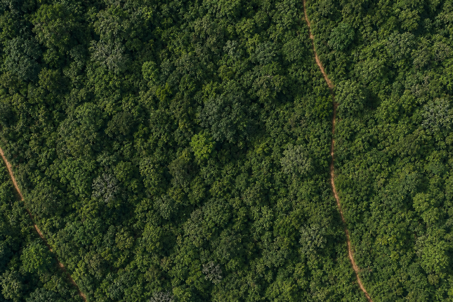
Baseline · 31 Dec 2020
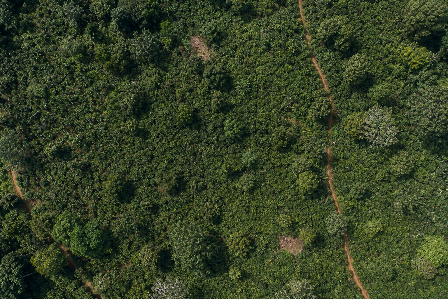
Latest pass · Jul 2026
Loss overlay on the 2020 basemap
Hectares cleared per year · 2020–2026
No forest loss detected inside the plot boundary between 2020 and 2026.
Polygon PLT-02
Akrofuma Cocoa Collective · Ghana
Size (ha)
22.1
Deforested Area (ha)
0.3
Share of plot
1.4 %
Coordinates: 7.1612, -2.0308; 7.1634, -2.0281; 7.1607, -2.0253; 7.1585, -2.0282
Baseline · 31 Dec 2020
Latest pass · Jul 2026
Loss overlay on the 2020 basemap
Hectares cleared per year · 2020–2026
Polygon PLT-03
Akrofuma Cocoa Collective · Ghana
Size (ha)
8.7
Deforested Area (ha)
2.4
Share of plot
27.6 %
Coordinates: 7.1724, -2.0187; 7.1741, -2.0162; 7.1718, -2.0141; 7.1701, -2.0166
Baseline · 31 Dec 2020
Latest pass · Jul 2026
Loss overlay on the 2020 basemap
Hectares cleared per year · 2020–2026
Risk Mitigation Applied
12 March 2026Supplier re-mapped the affected block and withdrew it from this shipment. The cleared 2.4 ha is excluded from the consignment and blocked from future deliveries.
3 supporting documents attached
concession-map-2023.pdf
PDF · 1.4 MB · K. Adjetey
plt-03-revised-boundary.geojson
GeoJSON · 86 KB · K. Adjetey
field-audit-report-mar-2026.pdf
PDF · 3.1 MB · N. Otoo · independent auditor
Polygon PLT-04
Akrofuma Cocoa Collective · Ghana
Size (ha)
15.9
Deforested Area (ha)
0.7
Share of plot
4.4 %
Coordinates: 7.1479, -2.0541; 7.1502, -2.0518; 7.1481, -2.0491; 7.1457, -2.0516
Baseline · 31 Dec 2020
Latest pass · Jul 2026
Loss overlay on the 2020 basemap
Hectares cleared per year · 2020–2026
Risk Mitigation Applied
4 April 2026A valid land-use permit and an on-site audit confirm the cleared strip is an access track outside the supplying block, with no post-cut-off conversion of the harvested area.
1 supporting document attached
land-use-permit-plt-04.pdf
PDF · 640 KB · K. Adjetey
Polygon PLT-05
Akrofuma Cocoa Collective · Ghana
Size (ha)
30.2
Deforested Area (ha)
0.4
Share of plot
1.3 %
Coordinates: 7.1388, -2.0652; 7.1417, -2.0624; 7.1391, -2.0596; 7.1363, -2.0627
Baseline · 31 Dec 2020
Latest pass · Jul 2026
Loss overlay on the 2020 basemap
Hectares cleared per year · 2020–2026
Prece un izcelsme
Cocoa beans · HS 1801.00 · Ghana · Akrofuma Cocoa Collective · PRC-24817
What's in the dossier
- 1Due Diligence Statement with its EU reference and verification number
- 2Risk analysis results — area, deforested hectares and risk band per polygon
- 3Per-year satellite imagery from the 2020 baseline to today, cropped to the plot
- 4Deforestation overlay — the year-coloured loss footprint, with hectares per year
- 5Mitigation record for every flagged plot, with its evidence documents attached
- 6Commodity & origin — product, HS code, country, supplier and the process it belongs to
Attached documents
Evidence uploaded against the 2 polygons that required mitigation.
concession-map-2023.pdf
PLT-03 · PDF · 1.4 MB · 12 Mar 2026
plt-03-revised-boundary.geojson
PLT-03 · GeoJSON · 86 KB · 12 Mar 2026
field-audit-report-mar-2026.pdf
PLT-03 · PDF · 3.1 MB · 14 Mar 2026
land-use-permit-plt-04.pdf
PLT-04 · PDF · 640 KB · 4 Apr 2026
Kāpēc ERWAY
Pārvērtiet regulatīvo slogu atkārtojamā procesā
ERWAY tika veidots no sākuma līdz beigām ES Meža izciršanas regulai, lai atbilstības komandas varētu pārliecinoši pāriet no neapstrādātiem piegādātāju datiem uz iesniegtu deklarāciju.
Viena savienota darbplūsma
Ģeometrija, risks, pierādījumi un iesniegšana dzīvo vienā sistēmā — vairs nav jāsalāgo rīki un izklājlapas.
Pierādījumu līmeņa dati
Katru rādītāju atbalsta satelīta slāņi un dokumentēts atskaites punkts, tāpēc jūsu secinājumi iztur pārbaudi.
Portfeļa redzamība
Riska analītika apkopo tūkstošiem zemesgabalu skaidrās tendencēs pa precēm, piegādātājiem un valstīm.
Gatavs iesniegšanai
Ģenerējiet un iesniedziet DDS ES informācijas sistēmā un glabājiet katru atsauci vienā auditējamā vietā.
ERP gatavi API
Pilnībā dokumentēti API, lai ERWAY pieslēgtos jūsu ERP — integrācijai gatavi galapunkti, nevis melnā kaste.
GDPR droša glabāšana
Veidots ES datu aizsardzībai ar sadalītu struktūru, un mēs apņemamies ievērot EUDR piecu gadu pierādījumu glabāšanas pienākumu.
Riska analīze
Portfeļa līmeņa skats par katru procesu, piegādātāju un zemes gabalu.
Riska sadale
Procesi mēnesī
Populārākās preces pēc apjoma
Katrs secinājums balstās uz pierādījumu kopumu
Zemesgabals nekad netiek vērtēts pēc viena attēla. ERWAY nolasa to pašu zemes gabalu caur slāņiem, no kuriem katrs atbild uz citu jautājumu — kur stāvēja mežs, ko jūs piegādājāt, kas tur aug, kāda ir zeme, ko redzēja satelīts un kas mainījās — pēc tam apvienojot tos vienā aizstāvamā atbildē.
Signals
Meža zudums gadu pa gadam, gandrīz reāllaika traucējumu brīdinājumi ar norādītu izraisītāju un degšanas pēdas — pierādījums, ka kaut kas ir mainījies.
Globāli meža uzraudzības un ugunsgrēku dati
Imagery
Patiesu krāsu attēls katram gadam no atskaites punkta līdz šodienai, apgriezts līdz zemesgabalam, lai pārskatītājs var redzēt zemi, nevis uzticēties tikai rādītājam.
Publisks satelīta arhīvs, viens pārlidojums sezonā
Plots
Zemesgabala ģeometrija, ko nodod jūsu piegādātāji, validēta struktūras, topoloģijas un atrašanās vietas ziņā, pirms tiek nolasīts neviens pikselis.
Jūsu pašu augšupielādes, pārbaudītas ienākot
Argumentācija aiz katra secinājuma
Zemesgabals nekad netiek novērtēts ar vienu rupju noteikumu. Vispirms tiek pierādīta tā ģeometrija, pēc tam tas tiek novirzīts pa ceļu, kas veidots tam, kas uz tā aug — jo kafijas dārzs, sojas lauks un koksnes plantācija katrs atstāj pilnīgi atšķirīgu parakstu tajā pašā satelīta ierakstā.
Every plot earns its way in
Before a single pixel of satellite data is read, the submitted geometry is put through a battery of structural, topological and locational checks. Plots that cannot be trusted are stopped here — not silently scored.
- Plot geometry is submitted.
- If its structure or format is not valid, validation fails and the plot cannot proceed.
- If the polygon topology is not sound, validation fails.
- If location or duplication checks do not come back clear, the plot is routed to manual review.
- If the plot is a water body or otherwise non-productive land, it is flagged for manual review.
- Otherwise the plot enters commodity risk assessment.
Ritiniet sāniski, lai sekotu visam ceļam.
Vārtu iekšpusē
Trīspadsmit pārbaudes, katrs zemesgabals, katra augšupielāde
Format
- Trūkstoša vai tukša ģeometrija
- Nederīgs GeoJSON
- Ģeometrijas veids netiek atbalstīts
Ģeometrija
- Poligona gredzens nav noslēgts
- Nederīga poligona topoloģija (paškrustošanās)
- Iespējama garuma/platuma secības kļūda
- Iekšējais gredzens (caurums) poligonā
- Zemesgabala platība ārkārtīgi maza
- Zema koordinātu precizitāte
Dublēšanās
- Dublēta ģeometrija tajā pašā failā
- Pārklājošies zemesgabali
Atrašanās vieta
- Centroīds ārpus paredzamās valsts robežām
- Ļoti tuvu references pilsētas punktam
Bloķē iesniegšanu·Atzīmē pārskatīšanai·Katram noteikumam ir stabils kods, lai integrācijas varētu programmatiski reaģēt uz atklājumiem.
Sliekšņi, svari un pamatā esošie datu avoti ir konfigurēti katrai precei un koplietoti saskaņā ar NDA. Iepriekš redzamie ceļi parāda lēmumu struktūru — nevis tās pamatā esošo kalibrāciju.
Savienojiet savas sistēmas ar EUDR uzticamības pārbaudi
EUDR API integrācija un EUDR TRACES integrācija vienā virsmā: pieslēdziet ERP, TMS vai savus stackus pie ERWAY — palaidiet procesus, izmantojiet to pašu atbilstības dzinēju kā produkts un sasniedziet DDS iesniegšanu caur EU TRACES bez riska darbplūsmu pārbūves.
Dokumentēts integratoriem
Testa un produkcijas dokumentācija ar skaidru ieteicamo izsaukumu secību — lai jūsu komanda pieslēdz ERWAY vienreiz un palaiž ar pārliecību.
Sāciet procesu no savas sistēmas
Uzsāciet uzticamības pārbaudi no ERP, TMS vai pielāgotas programmatūras — prece, piegādātājs un zemesgabala ģeometrija vienā procesa sākšanas izsaukumā.
Kopīgojiet ar saviem izplatītājiem
Autorizējiet izplatītāju lietotājus procesam tieši no savas sistēmas — tie paši atbilstības noteikumi un kvotas, kas ERWAY ekrānā.
ES TRACES DDS iesniegšana
Kad uzticamības pārbaude ir pabeigta, ERWAY iesniedz Due Diligence Statement ES TRACES un saglabā atsauci auditam.
Ieteicamā integrācijas plūsma
No procesa sākuma līdz ES TRACES
Dokumentēts ceļš, kam seko jūsu sistēmas — tas pats uzticamības pārbaudes dzinējs, kas ERWAY produktā.
- 1POSTSākt procesu
prece · piegādātājs · ģeometrija
- 2GETIzsekot atbilstību
risks · statuss · progress
- 3POSTAutorizēt izplatītājus
kopīgot procesu · piešķirt · atsaukt
- 4→Iesniegt DDS ES TRACES
deklarācija iesniegta · atsauce reģistrēta
Pilna dokumentācija un piekļuves dati tiek koplietoti ar apstiprinātiem integratoriem — šeit nav publicēti.
Skatiet, kā ERWAY darbojas no sākuma līdz beigām
Izmēģiniet divu minūšu interaktīvo ekskursiju, tad runājiet ar mums par tās palaišanu ar jūsu pašu piegādātāju datiem.