EUDR compliance software, from plot geometry to EU submission.
ERWAY is EUDR compliance software that turns supplier plot geometry into satellite-backed deforestation risk intelligence — with compliance automation through to a submission-ready Due Diligence Statement to the EU, without leaving the platform.
No signup — the demo runs entirely in your browser.
Overview
Total Processes
128
Compliant
96
Non-Compliant
12
Usage Limits
Risk Assessments
128/500
Polygon Uploads
4.210/10.000
DDS Uploads
84/250
Process Authorizations
37/50
User Creation Authorizations
12/25
Supplier Creation Authorizations
46/100
Recent EUDR Processes
| Process | Commodity | Origin | Risk | Status |
|---|---|---|---|---|
Cocoa beans — Akrofuma Q3 PRC-24817 · HS 1801.00 | Cocoa | Ghana | 8 | Compliant |
Arabica coffee — Montebrava PRC-24810 · HS 0901.11 | Coffee | Brazil | 14 | Compliant |
Natural rubber — Hatvien PRC-24796 · HS 4001.22 | Rubber | Vietnam | 61 | Non-Compliant |
Crude palm oil — Palmanusa PRC-24788 · HS 1511.10 | Oil palm | Indonesia | 44 | In Review |
Soya beans — Ruvalda PRC-24771 · HS 1201.90 | Soya | Argentina | 22 | Compliant |
Oak sawnwood — Codruna PRC-24759 · HS 4407.91 | Wood | Romania | 5 | Compliant |
One workflow for every EUDR commodity
7
Regulated commodities covered
2020
Deforestation baseline enforced
1-click
Due Diligence Statement filing
The platform
Everything EUDR asks for, in one connected workflow
From plot geometry to a filed statement — EUDR due diligence software, traceability software, risk assessment and geolocation in one connected workflow. Each module hands off cleanly to the next.
A live compliance cockpit
See your entire EUDR portfolio at a glance — compliant vs. non-compliant consignments, plan usage and the latest processes, all in real time.
- Portfolio-wide compliance and risk KPIs
- Usage limits for risk runs, polygons and DDS filings
- Every recent process with status and risk score
Overview
Total Processes
128
Compliant
96
Non-Compliant
12
Usage Limits
Risk Assessments
128/500
Polygon Uploads
4.210/10.000
DDS Uploads
84/250
Process Authorizations
37/50
User Creation Authorizations
12/25
Supplier Creation Authorizations
46/100
Recent EUDR Processes
| Process | Commodity | Origin | Risk | Status |
|---|---|---|---|---|
Cocoa beans — Akrofuma Q3 PRC-24817 · HS 1801.00 | Cocoa | Ghana | 8 | Compliant |
Arabica coffee — Montebrava PRC-24810 · HS 0901.11 | Coffee | Brazil | 14 | Compliant |
Natural rubber — Hatvien PRC-24796 · HS 4001.22 | Rubber | Vietnam | 61 | Non-Compliant |
Crude palm oil — Palmanusa PRC-24788 · HS 1511.10 | Oil palm | Indonesia | 44 | In Review |
Soya beans — Ruvalda PRC-24771 · HS 1201.90 | Soya | Argentina | 22 | Compliant |
Oak sawnwood — Codruna PRC-24759 · HS 4407.91 | Wood | Romania | 5 | Compliant |
Defensible deforestation risk, automatically
Each process is scored plot-by-plot against the 2020 forest baseline, then rolled into a single verdict you can stand behind in an audit.
- Per-plot forest-loss and alert-density scoring
- Commodity, HS code, supplier and geolocation captured together
- Clear compliant / non-compliant / in-review outcomes
Crude palm oil — Palmanusa
Deforestation risk score
Aggregated from per-plot forest-loss, alert density and land-cover change since the 2020 baseline.
Process details
Commodity
Oil palm · Crude palm oil
HS code
1511.10
Supplier
Palmanusa Estates
Country of production
Indonesia
Total plot area
512,9 ha
GFC 2020 forest baseline
418.6 ha
Plot-level results
5 plots analysed| Plot | Area | Forest loss | Risk |
|---|---|---|---|
| PLT-01 | 12.4 ha | 0.0 ha | none |
| PLT-02 | 22.1 ha | 0.3 ha | low |
| PLT-03 | 8.7 ha | 2.4 ha | high |
| PLT-04 | 15.9 ha | 0.7 ha | medium |
| PLT-05 | 30.2 ha | 0.4 ha | low |
Satellite evidence behind every score
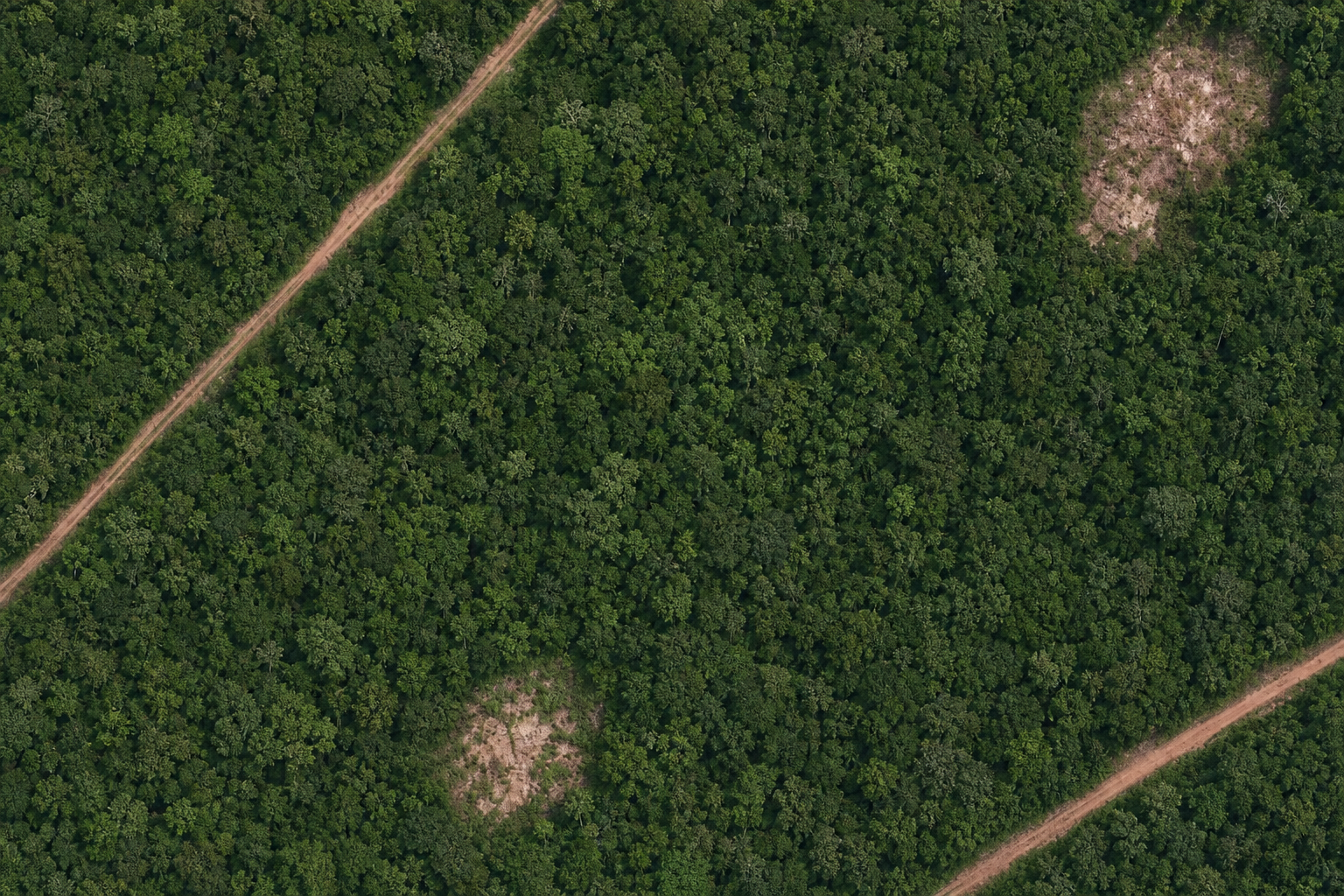
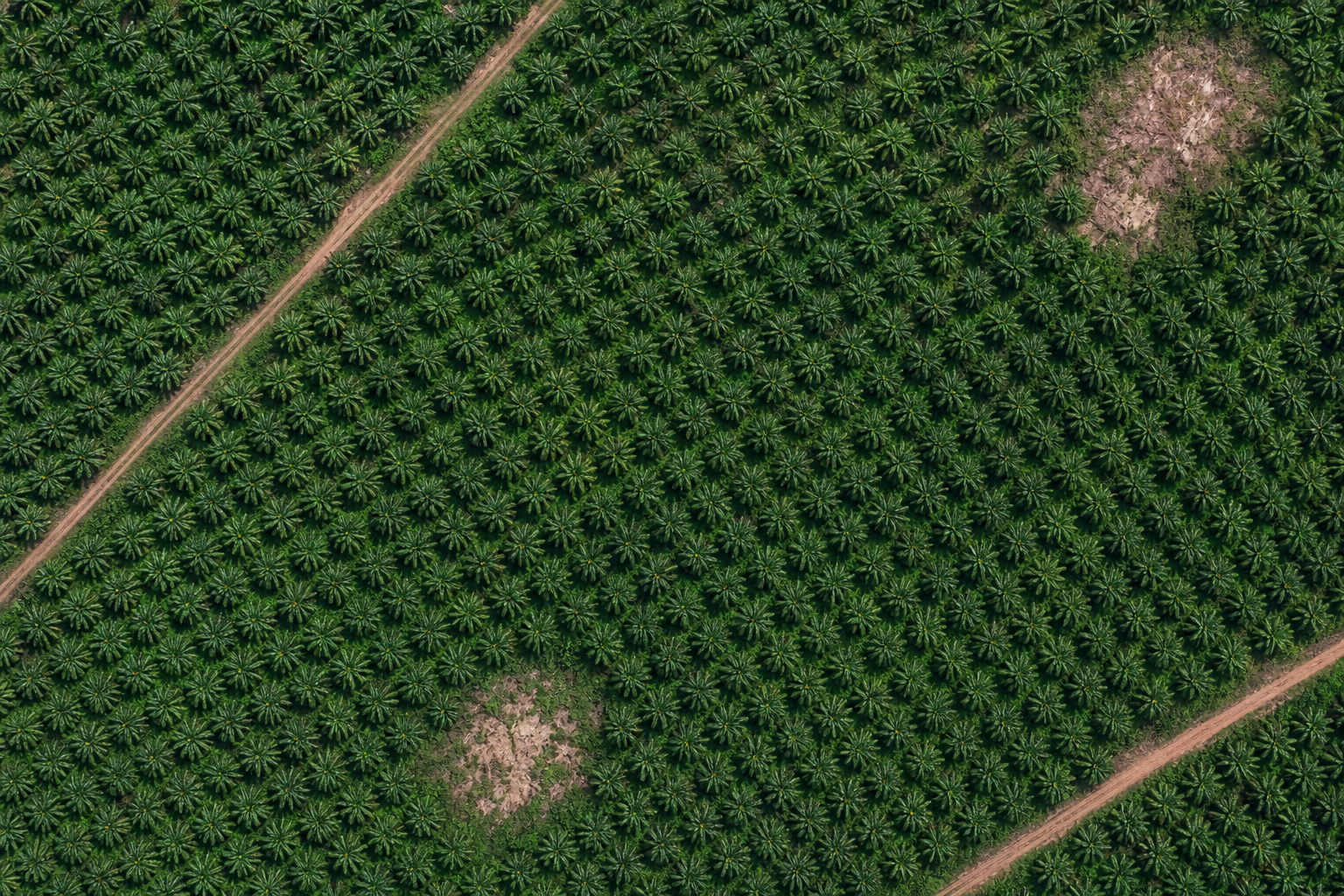
Slide from the 2020 forest baseline to today's real satellite image on the same plot — so you can see exactly what the land looks like now versus before the cut-off.
- Before/after: 2020 forest vs. today's land use
- Real high-resolution satellite imagery
- Works across every EUDR commodity
Deforestation analysis
Palmanusa Estates · 176 plots · Indonesia · drag to compare 2020 vs. today
Layers
Legend color code
Year-by-year loss on a forest basemap
Overlay deforestation on the 2020 forest satellite image — each colour marks when a patch was cleared inside the plot boundary.
- Forest basemap with no before/after split
- Year-coloured heatmap inside the plot
- Legend colour code from 2020 through today
Deforestation analysis
Palmanusa Estates · 176 plots · Indonesia · year-by-year loss on the 2020 forest baseline
Layers
Legend color code
Screen every supplier for hidden risk
ERWAY scans watchdog, court and news sources for each supplier and turns the findings into an overall risk score, red flags and recommended next steps.
- AI adverse-media screening per supplier
- Findings with severity and why they matter for EUDR
- Red flags, gaps and recommended next steps
Natural rubber — Hatvien
Hatvien Rubber JSC screened across watchdog, court and news sources. Score aggregates finding severity, source reliability and supply-chain proximity.
Hatvien Rubber JSC
Supplier under review
Geographic footprint
Aliases screened
Parent companies
Subsidiaries
Findings (2)
Finding 1 / 2
NGO report links concession to 2023 forest clearance
An investigative report alleges a supplying concession cleared natural forest in 2023, overlapping community-claimed land near the plot boundary.
Why this matters for EUDR
Clearing after the 31 Dec 2020 cut-off on land feeding this consignment would make the commodity non-compliant and expose the operator to EUDR penalties.
Finding 2 / 2
Provincial authority fined an affiliate for a land-use breach
A court record shows an affiliated entity was fined for a land-use permit breach; the link to the screened supplier is via a shared parent company.
Why this matters for EUDR
Regulatory breaches by affiliates raise the likelihood of weak land-legality controls across the group.
Key red flags
3 items- Deforestation: NGO evidence of 2023 clearance near supplying plots
- Land rights: overlap with community-claimed land
- Group risk: affiliate fined for a land-use breach
Information gaps and uncertainties
- Concession boundary maps were not publicly available
- No response yet from the supplier on the 2023 clearance allegation
Coverage: Screened 42 sources across watchdog, court and news records in EN/VI over the last 24 months.
Score the human-rights risk pillar end to end
Beyond deforestation: score child labour, forced labour, modern slavery, trafficking, discrimination, overtime, wages and OHS — framed by OECD and ILO due-diligence guidance as fundamental human-rights risks.
- Category risk scores across core labour and human-rights themes
- Findings with severity, sources and recommended next steps
- Second risk pillar beside deforestation for full supplier evaluation
Natural rubber — Hatvien
OECD Due Diligence Guidance and ILO core labour standards frame these as fundamental human-rights risks in the supply chain.
Category risk scores
Open-source risk signals (4)
Signal 1 / 4 · Child labour
Seasonal harvest crews alleged to include under-age workers
A regional news desk report describes minors assisting on peak-season rubber tapping crews near the supplying district, without verified age checks.
news.example/seasonal-harvest-child-labour-2024Signal 2 / 4 · Modern slavery
Debt bondage indicators flagged in migrant worker camps
An open labour briefing cites passport retention and recruitment-fee debt among migrant workers linked to a neighbouring processing site in the same supply corridor.
news.example/migrant-debt-bondage-indicatorsSignal 3 / 4 · Forced labour
Forced overtime reported during export rush weeks
A trade-desk investigation recounts workers saying exit was restricted during consecutive night shifts when export quotas spiked.
news.example/forced-overtime-export-rushSignal 4 / 4 · Low wages
Local wage dispute over piece-rate shortfalls
A field correspondent note covers a short-lived wage dispute after piece rates fell below the regional floor for two consecutive months — later partly remediated.
news.example/piece-rate-wage-dispute-2023Key red flags
3 items- Child labour: under-age workers alleged on seasonal harvest crews
- Modern slavery: debt bondage indicators in migrant camps
- Forced labour: exit restricted during export rush overtime
Information gaps
- No independent social audit for the last 24 months
- Supplier has not confirmed age-verification controls for casual labour
End-to-end supplier evaluation: deforestation risk plus this legality pillar in one due-diligence file.
Example links are illustrative placeholders — not live publications.
Prove what you did about it
For every flagged plot, record the mitigation measure and attach the evidence behind it — permits, concession maps, field audits — against that exact polygon.
- A description plus supporting documents, per polygon
- PDF, JPEG, PNG, DOCX, XLSX, EML and MSG — up to 10 files
- Marks the plot “Risk Mitigation Applied” and the process compliant
Cocoa beans — Akrofuma Q3
| Polygon | Size (ha) | Deforested (ha) | Share | Risk | Actions |
|---|---|---|---|---|---|
| PLT-01 | 12.4 | 0.0 | 0.0 % | No risk | — |
| PLT-02 | 22.1 | 0.3 | 1.4 % | Low risk | |
| PLT-03 | 8.7 | 2.4 | 27.6 % | Risk Mitigation Applied | 3 |
| PLT-04 | 15.9 | 0.7 | 4.4 % | Risk Mitigation Applied | 1 |
| PLT-05 | 30.2 | 0.4 | 1.3 % | Low risk |
Risk Mitigation
Recorded mitigation entries
Description
Supporting documents(3 files)
concession-map-2023.pdf
1.4 MB
plt-03-revised-boundary.geojson
86 KB
field-audit-report-mar-2026.pdf
3.1 MB
Add new entry
Enter a description or at least one document; you may provide both.
Description(optional)
155/4000
Supporting documents(optional)
Drag and drop files here or use the button below
PDF, JPEG, PNG, DOCX, XLSX, EML, MSG — max 10 files, 10 MB each
Your supplier & plot network, mapped
Import plot geometry from GeoJSON and manage every supplier, plot and hectare in one place — ready to reuse across processes.
- GeoJSON import for supplier plots
- Plots, area and risk per supplier
- Reusable across every EUDR process
Suppliers
Manage supplier network, plots and due-diligence evidence.
Suppliers
6
Mapped plots
1.391
Total area
33.482 ha
| Supplier | Commodity | Plots | Area | Questionnaire | Risk |
|---|---|---|---|---|---|
Akrofuma Cocoa Collective SUP-1042 · Ghana | Cocoa | 214 | 3.120,4 ha | Completed | low |
Montebrava Coffee Coop SUP-1039 · Brazil | Coffee | 512 | 8.804,1 ha | Completed | none |
Hatvien Rubber JSC SUP-1036 · Vietnam | Rubber | 88 | 1.290,7 ha | Sent | high |
Palmanusa Estates SUP-1031 · Indonesia | Oil palm | 176 | 5.410,9 ha | Sent | medium |
Ruvalda Agro SA SUP-1028 · Argentina | Soya | 340 | 12.750 ha | Draft | low |
Codruna Timber SRL SUP-1024 · Romania | Wood | 61 | 2.105,5 ha | Completed | none |
Register suppliers into your network
Search for an existing supplier or create a new one with contact details — and optionally grant GeoJSON upload permission so they can submit plot polygons.
- Search by name, country and city first
- Create with address, email and phone
- Optional GeoJSON upload permission + invite
Add Supplier
Manage supplier information
Supplier Name: Okrantu Cocoa Ltd
Ghana, Accra
Grant this supplier GeoJSON upload permission
Creates a login so the supplier can upload plot polygons. An invite email is sent to the address below.
Build, send and score supplier surveys
Compose a survey in the builder, send a secure single-use link, and review answers with an automatic risk level and mitigation tracking.
- Drag-free builder with six question types
- Secure single-use links, sent by email
- Per-answer auto risk + mitigation actions
Supplier Questionnaires
Build assessment forms, send secure links to suppliers, and analyze the results.
Templates
2 version(s)
1 version(s)
3 version(s)
EUDR Supplier Self-Declaration (v2)
Question types: Single choice · Multiple choice · Yes / No · Free text · Date · Document only
File the DDS to the EU in one click
When due diligence is complete, ERWAY generates and submits the Due Diligence Statement to the EU Information System and stores the reference for you.
- Auto-built statement from the process data
- Geolocation attached automatically
- Reference and verification numbers captured
Submit DDS
Generate and file the Due Diligence Statement to the EU Information System.
Statement summary
Operator
ERWAY Compliance GmbH · EORI DE000000000
Commodity / HS
Cocoa beans · HS 1801.00
Geolocation
214 plots · GeoJSON attached (3,120 ha)
Risk conclusion
Negligible risk — due diligence complete
Submission accepted
EU Information System · TRACES
- Data validated
- Geolocation attached
- Submitted to EU TRACES
- Reference issued
DDS reference number
25XXDEMO0000000X0Verification number
DEMO0000One audit-ready dossier per process
Every polygon result, satellite image, deforestation overlay and mitigation document is assembled into a single report — filed against the process and kept for the full five years the regulation requires.
- Per-polygon results with per-year satellite imagery
- Mitigation records with supporting documents attached
- Archived for five years to meet the EUDR record-keeping duty
DDS Report
PRC-24817 · Cocoa beans — Akrofuma Q3 · 5 polygons, their evidence and their paperwork in one file

Due Diligence Statement
Ref 25XXDEMO0000000X0 · Generated 2 August 2026
Summary
Compliance status
Compliant
Created date
18 July 2026
Status
Submitted to EU TRACES
Polygons
5
Total area
89.3 ha
Deforested
3.8 ha · mitigated
Operator & process information
Company
ERWAY Compliance GmbH
EORI
DE000000000
Product
Cocoa beans
HS code
1801.00
Country of production
Ghana
Lot number
LOT-2026-Q3-118
Supplier
Akrofuma Cocoa Collective · SUP-1042
Quantity
24,000 kg net mass
Risk analysis results · all 5 polygons
| Polygon | Size (ha) | Deforested (ha) | Share | Risk | Mitigation |
|---|---|---|---|---|---|
| PLT-01 | 12.4 | 0.0 | 0.0 % | No risk | Not required |
| PLT-02 | 22.1 | 0.3 | 1.4 % | Low risk | Not required |
| PLT-03 | 8.7 | 2.4 | 27.6 % | High risk | Applied · 3 docs |
| PLT-04 | 15.9 | 0.7 | 4.4 % | Medium risk | Applied · 1 doc |
| PLT-05 | 30.2 | 0.4 | 1.3 % | Low risk | Not required |
Polygon PLT-01
Akrofuma Cocoa Collective · Ghana
Size (ha)
12.4
Deforested Area (ha)
0.0
Share of plot
0.0 %
Coordinates: 7.1541, -2.0417; 7.1558, -2.0394; 7.1536, -2.0372; 7.1519, -2.0399
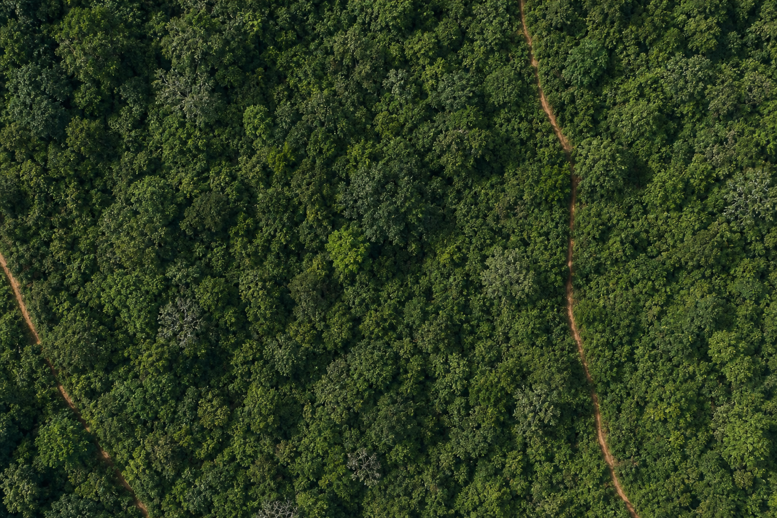
Baseline · 31 Dec 2020
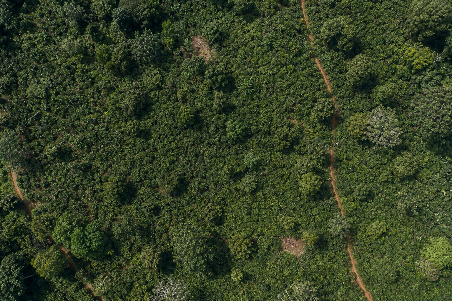
Latest pass · Jul 2026
Loss overlay on the 2020 basemap
Hectares cleared per year · 2020–2026
No forest loss detected inside the plot boundary between 2020 and 2026.
Polygon PLT-02
Akrofuma Cocoa Collective · Ghana
Size (ha)
22.1
Deforested Area (ha)
0.3
Share of plot
1.4 %
Coordinates: 7.1612, -2.0308; 7.1634, -2.0281; 7.1607, -2.0253; 7.1585, -2.0282
Baseline · 31 Dec 2020
Latest pass · Jul 2026
Loss overlay on the 2020 basemap
Hectares cleared per year · 2020–2026
Polygon PLT-03
Akrofuma Cocoa Collective · Ghana
Size (ha)
8.7
Deforested Area (ha)
2.4
Share of plot
27.6 %
Coordinates: 7.1724, -2.0187; 7.1741, -2.0162; 7.1718, -2.0141; 7.1701, -2.0166
Baseline · 31 Dec 2020
Latest pass · Jul 2026
Loss overlay on the 2020 basemap
Hectares cleared per year · 2020–2026
Risk Mitigation Applied
12 March 2026Supplier re-mapped the affected block and withdrew it from this shipment. The cleared 2.4 ha is excluded from the consignment and blocked from future deliveries.
3 supporting documents attached
concession-map-2023.pdf
PDF · 1.4 MB · K. Adjetey
plt-03-revised-boundary.geojson
GeoJSON · 86 KB · K. Adjetey
field-audit-report-mar-2026.pdf
PDF · 3.1 MB · N. Otoo · independent auditor
Polygon PLT-04
Akrofuma Cocoa Collective · Ghana
Size (ha)
15.9
Deforested Area (ha)
0.7
Share of plot
4.4 %
Coordinates: 7.1479, -2.0541; 7.1502, -2.0518; 7.1481, -2.0491; 7.1457, -2.0516
Baseline · 31 Dec 2020
Latest pass · Jul 2026
Loss overlay on the 2020 basemap
Hectares cleared per year · 2020–2026
Risk Mitigation Applied
4 April 2026A valid land-use permit and an on-site audit confirm the cleared strip is an access track outside the supplying block, with no post-cut-off conversion of the harvested area.
1 supporting document attached
land-use-permit-plt-04.pdf
PDF · 640 KB · K. Adjetey
Polygon PLT-05
Akrofuma Cocoa Collective · Ghana
Size (ha)
30.2
Deforested Area (ha)
0.4
Share of plot
1.3 %
Coordinates: 7.1388, -2.0652; 7.1417, -2.0624; 7.1391, -2.0596; 7.1363, -2.0627
Baseline · 31 Dec 2020
Latest pass · Jul 2026
Loss overlay on the 2020 basemap
Hectares cleared per year · 2020–2026
Commodity & origin
Cocoa beans · HS 1801.00 · Ghana · Akrofuma Cocoa Collective · PRC-24817
What's in the dossier
- 1Due Diligence Statement with its EU reference and verification number
- 2Risk analysis results — area, deforested hectares and risk band per polygon
- 3Per-year satellite imagery from the 2020 baseline to today, cropped to the plot
- 4Deforestation overlay — the year-coloured loss footprint, with hectares per year
- 5Mitigation record for every flagged plot, with its evidence documents attached
- 6Commodity & origin — product, HS code, country, supplier and the process it belongs to
Attached documents
Evidence uploaded against the 2 polygons that required mitigation.
concession-map-2023.pdf
PLT-03 · PDF · 1.4 MB · 12 Mar 2026
plt-03-revised-boundary.geojson
PLT-03 · GeoJSON · 86 KB · 12 Mar 2026
field-audit-report-mar-2026.pdf
PLT-03 · PDF · 3.1 MB · 14 Mar 2026
land-use-permit-plt-04.pdf
PLT-04 · PDF · 640 KB · 4 Apr 2026
Why ERWAY
Turn a regulatory burden into a repeatable process
ERWAY was built end-to-end for the EU Deforestation Regulation, so compliance teams can move from raw supplier data to a filed statement with confidence.
One connected workflow
Geometry, risk, evidence and submission live in a single system — no more stitching tools and spreadsheets together.
Evidence-grade data
Every score is backed by satellite layers and a documented baseline, so your conclusions hold up under scrutiny.
Portfolio visibility
Risk analytics roll thousands of plots into clear trends across commodities, suppliers and countries.
Submission-ready
Generate and file the DDS to the EU Information System and keep every reference in one auditable place.
ERP-ready APIs
Fully documented APIs so ERWAY plugs into your ERP — integration-ready endpoints, not a black box.
GDPR-safe retention
Built for EU data protection with a distributed posture, and we commit to the EUDR five-year evidence retention duty.
Risk Analytics
Portfolio-level view across every process, supplier and plot.
Risk distribution
Processes per month
Top commodities by volume
Every verdict stands on a stack of evidence
A plot is never judged from a single image. ERWAY reads the same patch of ground through layers that each answer a different question — where forest stood, what you supplied, what it grows, what the land is, what the satellite saw, and what changed — then reconciles them into one defensible answer.
Signals
Forest loss year by year, near-real-time disturbance alerts with an attributed driver, and burn scars — the evidence that something changed.
Global forest-monitoring and fire records
Imagery
A true-colour scene for every year from the baseline to today, cropped to the plot, so a reviewer can see the ground rather than take a score on trust.
Public satellite archive, one pass per season
Safeguards
Protected areas, national parks, and indigenous and community land — so a plot can be flagged for where it sits, not only for what changed on it.
Official land designations
Commodity
Which of the seven regulated commodities the plot supplies, and under which HS code. This is what routes it down a perennial, annual or timber pathway — a coffee grove, a soy field and a timber plantation each leave a different signature on the same satellite record.
Declared per process, carried on the statement
Plots
The plot geometry your suppliers hand over, validated for structure, topology and location before a single pixel is read.
Your own uploads, checked on arrival
Baseline
Where forest stood on the 2020 cut-off date, and what kind of forest it was — the reference every later verdict is measured against.
Independent EU reference mapping
The reasoning behind every verdict
A plot is never scored by one blunt rule. Its geometry is proven first, then routed down a pathway built for what is growing on it — because a timber plantation, a coffee grove and a soy field each leave a completely different signature on the same satellite record.
Every plot earns its way in
Before a single pixel of satellite data is read, the submitted geometry is put through a battery of structural, topological and locational checks. Plots that cannot be trusted are stopped here — not silently scored.
- Plot geometry is submitted.
- If its structure or format is not valid, validation fails and the plot cannot proceed.
- If the polygon topology is not sound, validation fails.
- If location or duplication checks do not come back clear, the plot is routed to manual review.
- If the plot is a water body or otherwise non-productive land, it is flagged for manual review.
- Otherwise the plot enters commodity risk assessment.
Scroll sideways to follow the full pathway.
Inside the gate
Thirteen checks, every plot, every upload
Format
- Missing or empty geometry
- Invalid GeoJSON
- Geometry type not supported
Geometry
- Polygon ring not closed
- Invalid polygon topology (self-intersection)
- Possible longitude/latitude order error
- Interior ring (hole) in polygon
- Plot area extremely small
- Low coordinate precision
Duplication
- Duplicate geometry in the same file
- Overlapping plots
Location
- Centroid outside expected country extent
- Very close to reference city point
Blocks submission·Flags for review·Every rule carries a stable code, so integrations can react to findings programmatically.
Thresholds, weightings and the underlying data sources are configured per commodity and shared under NDA. The pathways above show the decision structure — not the calibration behind it.
Connect your systems to EUDR due diligence
EUDR API integration and EUDR TRACES integration in one surface: wire ERP, TMS or custom stacks into ERWAY — start processes, run the same compliance engine as the product, and reach EU TRACES DDS submission without rebuilding risk workflows.
Documented for integrators
Sandbox and production docs with a clear recommended call order — so your team wires ERWAY once and ships with confidence.
Start a process from your stack
Kick off due diligence from ERP, TMS or custom software — commodity, supplier and plot geometry in one start-process call.
Share with your distributors
Authorize distributor users on a process straight from your own system — the same eligibility rules and quotas as the ERWAY screen.
EU TRACES DDS submission
When due diligence is complete, ERWAY files the Due Diligence Statement to EU TRACES and stores the reference for audit.
Recommended integration flow
From start process to EU TRACES
A documented path your systems follow — the same due-diligence engine as the ERWAY product.
- 1POSTStart process
commodity · supplier · geometry
- 2GETTrack compliance
risk · status · progress
- 3POSTAuthorize distributors
share a process · grant · revoke
- 4→Submit DDS to EU TRACES
statement filed · reference captured
Full docs and credentials are shared with approved integrators — not published here.
See ERWAY work end-to-end
Take the two-minute interactive tour, then talk to us about running it on your own supplier data.